


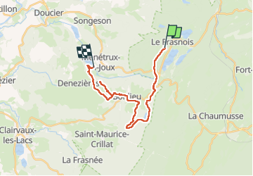

15,4 km | 20 km-effort

Utilisateur GUIDE


Application GPS de randonnée GRATUITE
 SityTrail
IGN / Instituts géographiques
SityTrail World
Le monde est à vous
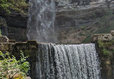
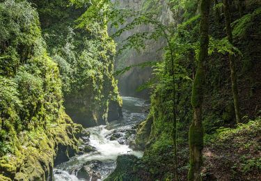
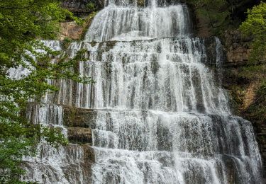
Randonnée Randonnée équestre de 21 km à découvrir à Bourgogne-Franche-Comté, Jura, Le Frasnois. Cette randonnée est proposée par holtzv.
Rando CVA JURA Mai 2024 : Jour 5 sur 5
Journée à cheval depuis l’Ecurie 4 Lacs vers le Parc Heria en passant par le lac de Bonlieu, la tourbière de Lautrey et le belvédère de la Dame Blanche

Marche

Marche

Marche
Marche

Marche
Marche
Randonnée équestre
Randonnée équestre
Marche